2011 Among Hottest Years, Marked by Extreme Weather
Not even cooling La Niña could take edge off warming trend.
A rendering shows Arctic sea ice.
An animation still using satellite data shows Arctic sea ice melt during the summer of 2011.
Image courtesy SVS/NASA
Richard A. Lovett
for National Geographic News
Published November 30, 2011
This year is shaping up to be one of the ten hottest years on record, according to a United Nations report announced yesterday.
Likewise, 2011 may be the hottest year on record during La Niña, a periodic cooling of the eastern tropical Pacific.
That's a bad sign, since La Niña years are generally relatively cool, said Steven Running, a professor of ecology at the University of Montana, who was not part of the study team.
So the new finding suggests that La Niña conditions that once produced strong global cooling now only slightly affect the overall temperature trend, Running said by email.
"What does it take now to have a cooling cycle?" he asked. "And what will happen in the next strong El Niño?"
El Niño is a warming of tropical waters in the central and eastern Pacific Ocean. During El Niño years, the warmer currents heat the planet on top of the steady global warming trend caused by human-induced greenhouse gases.
Based on data from 189 countries, the World Meteorological Organization (WMO) report was presented at an international climate conference this week in Durban, South Africa.
(Related: "Global Warming 'Marches On'; Past Decade Hottest Known.")
Climate Hot, and Getting Hotter
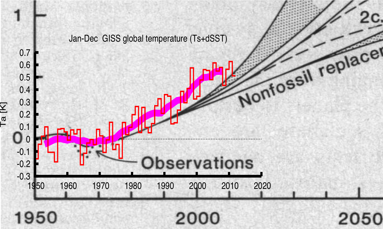
The report also found that all but two of the overall 15 hottest years since record-keeping began in 1850 have occurred between 1997 and 2011. (See "Heat Wave: 2010 to Be One of Hottest Years on Record.")
In addition, sea ice coverage was the second lowest on record. The lowest occurred in 2007.
Even that figure might be deceptively optimistic, because much of the sea ice appears to have been thinner than in past years. When sea ice cover was at its smallest in 2011, on September 9, the total Arctic sea ice volume was 8 percent lower than in 2010—previously the lowest on record, the WMO scientists found.
(See "Global Warming Silver Lining? Arctic Could Get Cleaner.")
The WMO's Global Atmosphere Watch program also recently released a report concluding that heat-trapping greenhouse gases in the atmosphere had reached a new high—an increase that will only continue, researchers say.
"Our science is solid, and it proves unequivocally that the world is warming and that this warming is due to human activities," WMO Secretary-General Michel Jarraud said in a statement addressing both reports.
(Quiz: Test your global warming knowledge.)
Floods, Droughts: A Year of Climate Extremes
This year was also full of extremes, according to this week's report.
Not surprisingly, given the high rates of melting in the Arctic, many Arctic regions were unusually hot. Parts of northern Russia reported springtime temperatures more than 16°F (9°C) above average, the WMO said.
(Related blog post: "Russia Burns in Hottest Summer on Record [2010].")
But there was plenty of other extreme weather elsewhere. For instance:
* Finland, Armenia, Central America, and Spain all reported record heat.
* It was the driest spring on record in many parts of western Europe, followed in some areas by the wettest summer.
* East Africa experienced severe drought followed by flooding.
* Other severe floods, often deadly, occurred in Southeast Asia, Brazil, Australia, Southern Africa, Central America, and Pakistan. (Read: "Extreme Storms and Floods Concretely Linked to Climate Change?")
* Tropical cyclone and hurricane activity was unusually low, although not as low as in 2010 (which had the lowest storm count since satellites first allowed accurate record keeping).
(See a world map of potential global warming impacts.)
Texas-Size Temperature Rise
Extremes were also present in the U.S. and Canada, where conditions ranged from drought and heat in the South to heavy snowpack in the Midwest to record-breaking rainfall in the Northeast.
It was also the third worst U.S. tornado season since 1950, after 2004 and 2008.
(Read "Monster Alabama Tornado Spawned by Rare 'Perfect Storm.'")
But the most stunning figures may have come from Texas, where daily temperatures averaged 86.7° (30.4°C), in June through August—a staggering 5.4°F (3.0°C) above normal, scientists said.
The Texas statistic is "the highest [such average] ever recorded for any American state," according to the WMO website.
It's difficult to determine exactly how much of the extremes are due to climate change versus normal weather variations, said Richard Alley, a geoscientist at Pennsylvania State University, who was not part of the WMO team.
"The increasing carbon dioxide and other greenhouse gases in the air from our activities do not make 'weather' disappear," he said by email. "But they do 'load the dice' to make hot conditions more likely.
"We haven't made cold snaps, and even record lows, disappear, but data and our physical understanding agree that we're still pushing strongly toward warming."
http://news.nationalgeographic.com/news ... vironment/ 


