Erakivnor wrote:I'm sorry for being so late, but I have been busy with the work for some time.
And it needs time to reply to some issues presented here (challenging! I need to study for them, this means I am learning something by the discussion even if I do no agree with the geology proposed !

).
That is a good sign if you need time to elaborate a reply. I also remarked that the quality of a post is proportional to the time I need to elaborate a reply. It happened once that I spent a couple of days reading a ton of papers to get a good grasp at the subject of a single post, and finally write a reply. So sure, in this case, it is a win-win situation. I'm sure we can learn a lot.
Erakivnor wrote:I want firs shortly address the GPS topic (noting that I am not an expert in the field). I want to address it in the view expansionVSconstant radius because someone told me that subduction is an assumption and expansion is an inference.
Just a reminder. The expansion is inferred from the geodynamics of arc systems and foldbelt. The Geodynamics does not support lithosphere recycling at the scale required by plate tectonics. In absence of that required recycling the expansion theory imposes itself naturally. For the same reason, subduction (synonymous to recycling in this context) is an unsupported assumption.
Erakivnor wrote:They both can be and assumption or an inference either.
Pre: vertical errors with GPS are averaged on the available year timespan, and the trends are inferred. thus "long"-term vertical behaviour and errors (in both space, and velocity) can be constrained.
Images below are chosen by Sella et al. 2002 JGR
The attachment Sella1.png is no longer available
The attachment Sella2.jpg is no longer available
and Argus et al. 2011 G^3.
The attachment Argus.jpg is no longer available
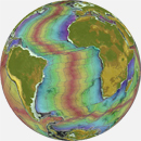
Then, just observing this it is pretty clear to me that respect to an orbital reference frame the kinematics of Plates fits quite well the common "assumption of opposing movement of plates at convergent margins.
Keep in mind that in this representation, sole the horizontal components of velocity vectors is represented on a projection of constant size, in an arbitrary referential (probably NNR, here). But we really want to measure the deformation of the shape of Earth.
The choice of referential is very important for the interpretations. For example
Crespi et al (2006) Geophys. J. Int. demonstrated that considering the eastward mantle flow, a referential with a lithosphere net rotation of 13.4 cm better matches geological constraints:

- net-rotation.jpg (882.54 KiB) Viewed 3466 times
That kind of change the perspective, isn'it?
Erakivnor wrote: But I will assume that following a "relativistic" way of thinking vectors at mid ocean ridges might be decoupled by vectors at continental edges and can not be related to the relative movements close to the trenches. This might be true from a first sight, but looking better at the map the trend is that Asia and America are moving one against each other closing the Pacific (while in an Expanding earth context I would expect the move further from one each other).
This expectation is incorrect because you assume an isotropic expansion. In reality, it is strongly anisotropic. In particular, the southern hemisphere is expanding much faster than the northern hemisphere (that's why the southern hemisphere is more oceanic). It can be seen in the latitudinal variation of spreading rates at MORs.
So if the model does not take into account the deformations of Earth, it would appear that the northern hemisphere is shrinking (!).
Erakivnor wrote:In addition we have no active tectonics in between that might justify a mechanical decoupling between ridges and trenches in the GPS measurements.
Actually, the opposite is true. The absence of active tectonics in between ridges and trenches demonstrate that they are mechanicaly decoupled in the horizontal dimension. In the expanding Earth, mechanical coupling is irrelevant, since the lithosphere dynamics is controlled by the mantle.
Erakivnor wrote: Moreover seamounts testify quite well the fact that the movement of the plate is really towards the trenches because their ages are decoupled by the magnetic anomalies.
By seamounts I guess you mean seamount chains like the Emperor chain? Seamount chains is just another evidence of the asymmetry of the expansion.
Erakivnor wrote:Well I want only to point out that one can interpret the GPS data in an EE view or in a PT view as follows:
1)EE: I see seafloor expansion, Movements of continents are overthrusting Oceans (the relativistic point of view, or hypothesis or assumption if you want) but the net expansion is nonzero because movements are decoupled: I INFER that the Earth grew.
2) PT: I see seafloor expansion, movements of continents are slower (deep rooted?) than the seafloor and net convergence is nonzero: I INFER that the Earth is not growing.
In the case of Hypotesizing something it's simply the reverse (which is what all geologists, both EE or PT geologists, did in the past). I make the EE or constant radius hypothesis and deduce what follows.
Again, the expansion is not an hypothesis, it is a direct inference from the geodata. The geological data show that there is no significant destruction of lithosphere to counterbalance the accretion at the MORs=> surface of Earth increases => Earth's size increases.
Erakivnor wrote:[well, then I look at double couple earthquake mechanisms,
Beach balls do not help to discriminate overthrusting vs undertrhusting.
Erakivnor wrote:age relationships of backarcs,
age relationships of back-arcs in the Philippine sea leave no doubt that the back-arcs only take the place of static Pacific lithosphere.

Erakivnor wrote:a-symmetry of orogens
Since orogenesis is controlled by mantle flows, the asymmetry of orogens result from the characteristics of the mantle flows.
Erakivnor wrote:, Earthquake distributions
Double Benioff zones are compatible with mantle-driven geodynamics.
Erakivnor wrote: and I have no doubts about picking the second option...only looking at the kinematics! no dynamics involved]
The dynamics is the key!
Erakivnor wrote:About previous images and comments by @
[color=#CC0000][b]Florian:[/b][/color]
The map of Anatolia is a classical example of the slab rollback "pull" in my opinion, however ignoring my personal opinion that map only shows that Anatolia moves towards Africa [the reference frame is the Europe].
More precisely, it shows that anatolia flows across a static substratum constituted by Africa/the Mediterranean sea/Europe.
And the rollback is mantle driven.
Erakivnor wrote: Still it depends on what you assume: if you assume that the Anatolia is an active side then oit overthrusts the Aegean ocean, if you assume subduction then Africa is the active plate.
Again, GPS reveals that the northern margin of Africa is static relatively to europe. So the only possible interpretation is that, anatolia is flowing across a static region. And of course, that motion is mantle-driven: mantle upwelling below eastern anatolia start to flow westward, then the flow bend southward heading toward the North African margin.
Erakivnor wrote: Again I don't see how this can support EE (or neither can disprove it).
It negates the hypothesis of subduction under Europe. The same reasoning applies for every active margins.
Erakivnor wrote:If you isolate that feature from the geological context you can think in both ways. Thinking on a wider view I see a net GPS movement of Europe towards Africa which is consistent with geological record....Tethys now in the mantle.
What is in the mantle is limited to what was on the path of the anatolian flow. And this is true for every active margins (see Philippine sea above).
In the field of observation, chance favors only the prepared mind. Louis Pasteur.

")


")
")

")


")